 Edge-of-field (EOF) monitoring projects are designed to collect accurate measurements of sediment, nitrogen and phosphorus movement over the soil surface and through subsurface drainage tiles. This work leads to a better understanding of the relationship between agricultural management and water quality.
History
Edge-of-Field monitoring began in Minnesota in 1997 with three sites as a part of the Red Top Tile Drainage Demonstration. Since then, EOF monitoring has been conducted as a part of 11 unique projects.
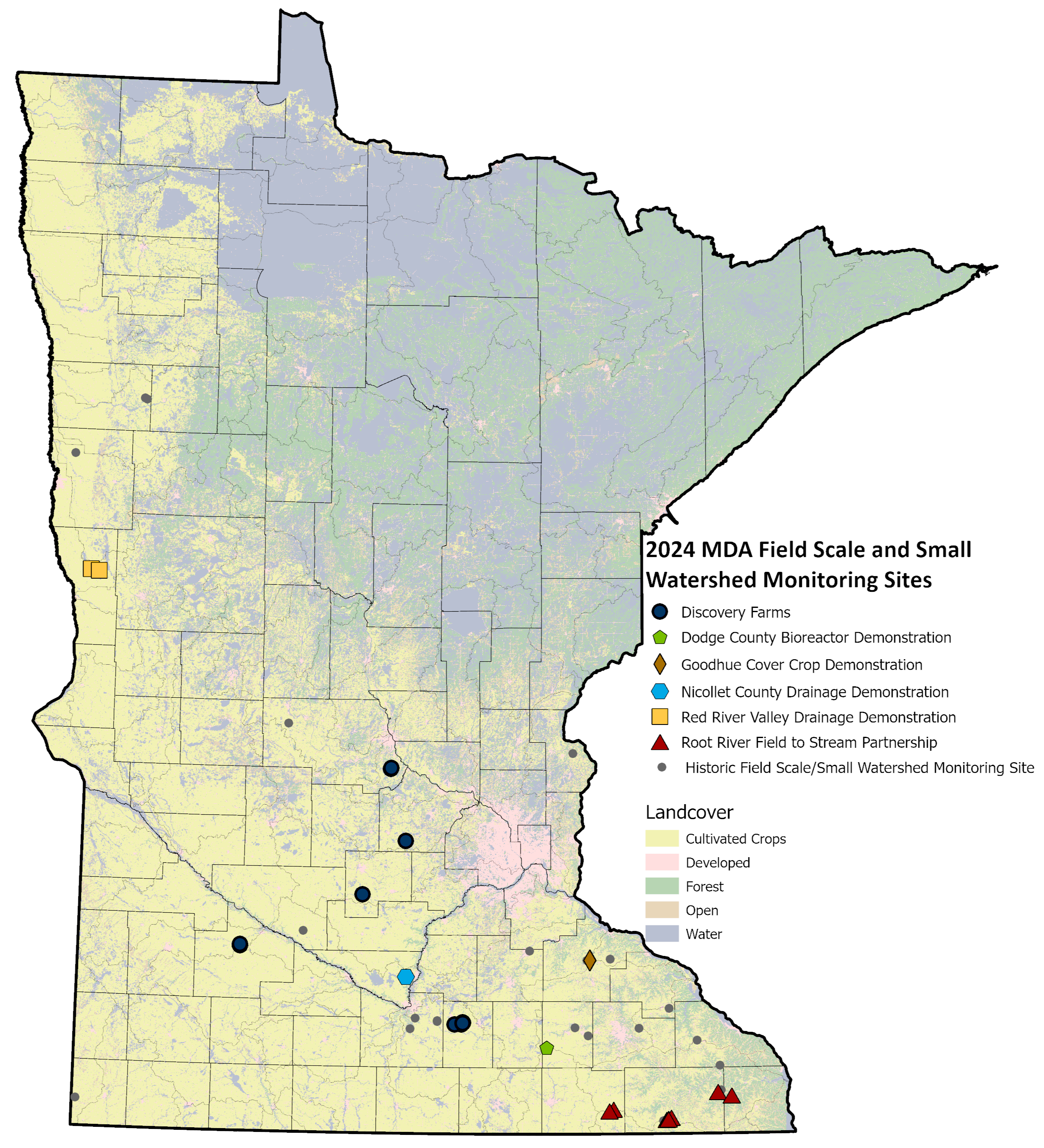
Current projects
- Dodge County Bioreactor Demonstration
- Discovery Farms Minnesota
- Goodhue Cover Crop Demonstration
- Nicollet County Drainage Demonstration
- Red River Valley Drainage Water Management
- Root River Field to Stream Partnership
Completed projects
- Clay County Drainage Demonstration
- Conservation Innovation Grant Monitoring EOF Monitoring Equipment Assessment
- Highway 90 Tile Demonstration
View the Evaluating Best Management Practice Effectiveness: Highway 90 Drainage Project presentation in the Minnesota Water Research Digital Library - Red Top Tile Demonstration
- St. Clair Vegetative Filter Strip Demonstration
The MDA, along with cooperators and partners, is responsible for installing and maintaining equipment to collect water quality, flow, meteorological and other project specific data.
Data Access
Most EOF locations transmit data every 30-60 minutes to an interactive website, MDA Near Real-Time Monitoring, so interested users can view the data being collected. Data on the website include weather (temperature, rain, wind, etc.), soil moisture and temperature, water level, flow, and nitrate concentrations. Data on the website are provisional and are finalized by MDA personnel during the winter. Contact MDA personnel for finalized data (See Contact Us).
Monitoring Sites
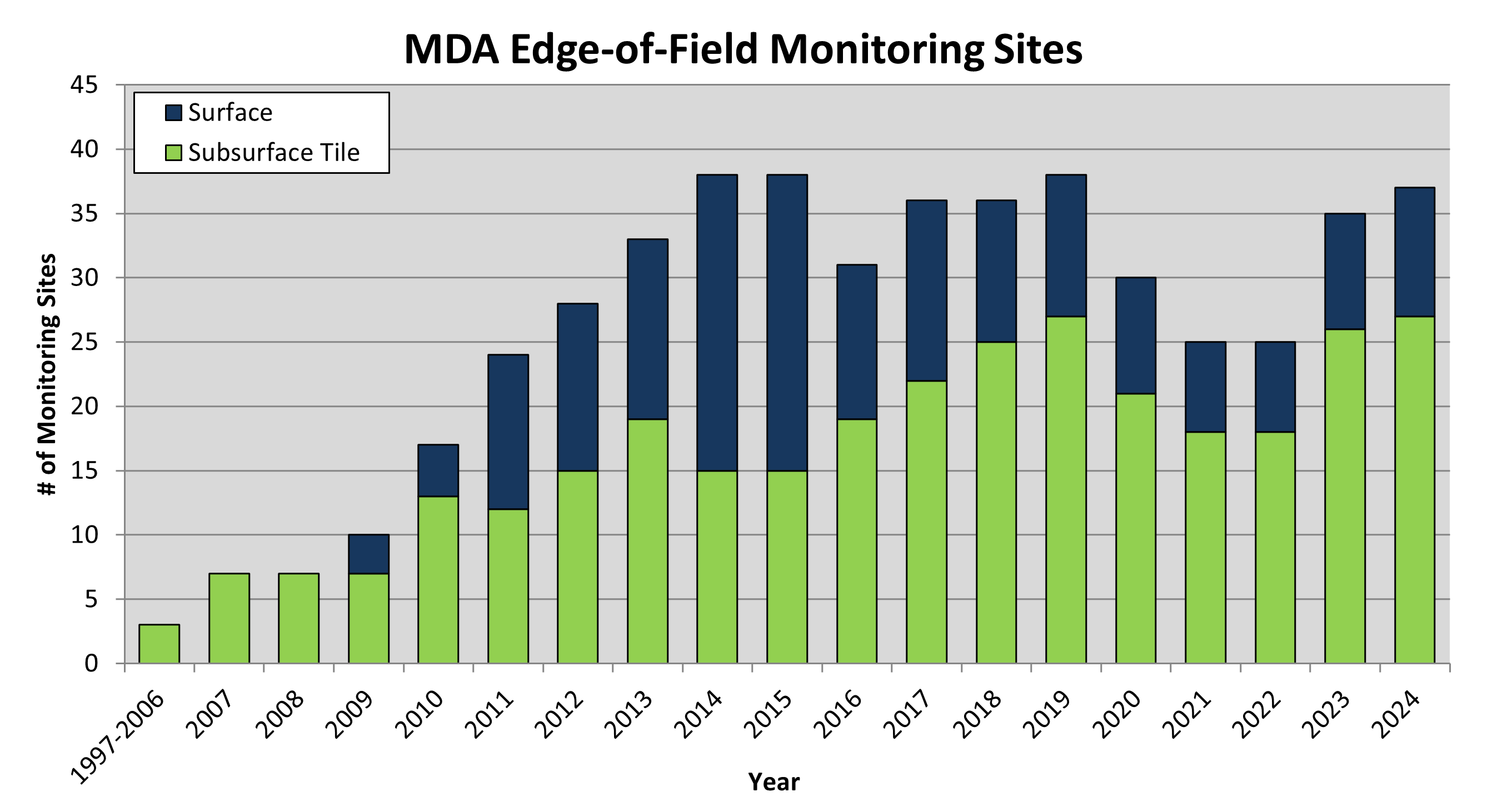
- Various projects have been created and completed since 1997. These projects are answering a variety of questions related to water quality and farming practices in both surface and subsurface runoff.
- From 1997-2008, demonstration sites were established to gain further information on the role of artificial subsurface tile drainage and water quality.
- In 2009, surface (overland) water quality and quantity monitoring began.
- In 2024, there were 10 surface water and 27 subsurface tile sites monitored across all MDA EOF programs.
- Monitoring sites have been located across the different types of agricultural areas in Minnesota encompassing a variety of farming operations.
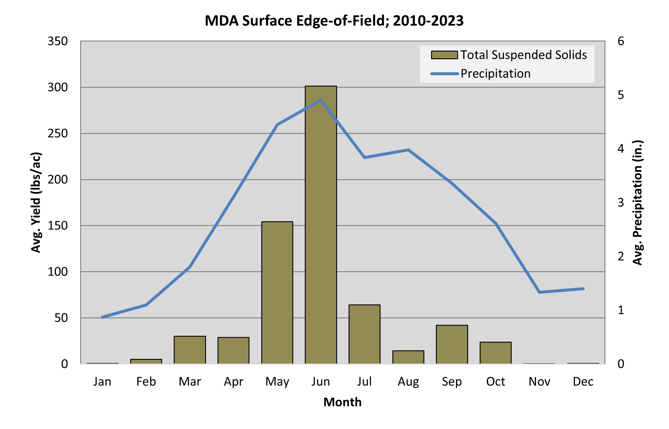
Sediment