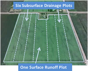
 The Clay County site was designed to evaluate the environmental impact of both surface and subsurface drainage from agricultural fields. This site includes six subsurface plots and one surface runoff plot, each approximately 22 acres in size.
The Red River Valley, in northwestern Minnesota, is experiencing an unprecedented increase in the amount of subsurface drainage tile being installed. Drainage tile is common in other areas of the state, however it is new to this region. The water quality impact of tiling in this region, with its unique soil and environmental conditions, has not been studied in detail.
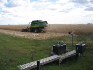
The soils and topography across the demonstration site represents field characteristics common in the most productive agricultural areas of the Red River Valley. Monitoring is occurring on a private farm, in cooperation with the producer. The site is approximately 155 acres in size.
Edge-of-Field Monitoring
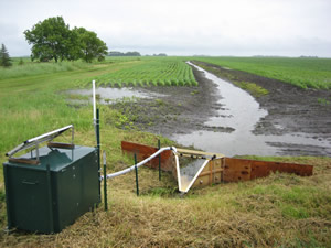 Edge-of-field monitoring stations provided information about the amount of water, nutrients, and sediment moving off a field by surface and subsurface drainage into an adjacent waterway. Seven edge-of-field sites were monitored separately and fully automated to collect water samples when drainage occurs.
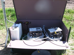
Water samples were tested for: total suspended solids, total phosphorous, dissolved phosphorous, nitrate and nitrite-nitrogen
Approximately 10-15 samples were collected annually from each plot. Automatic samplers collected water samples during storm events (when water was running through drainage tiles or over the field) and grab samples were manually collected during dry periods (i.e. between storms).
Preliminary data was collected in 2010. Automated samplers were installed and all equipment was operational through 2019. The results are summarized in the Clay County Drainage Site: Edge-of-Field Research in the Red River Valley fact sheet.

Learn More