
Adrian DWSMA Details
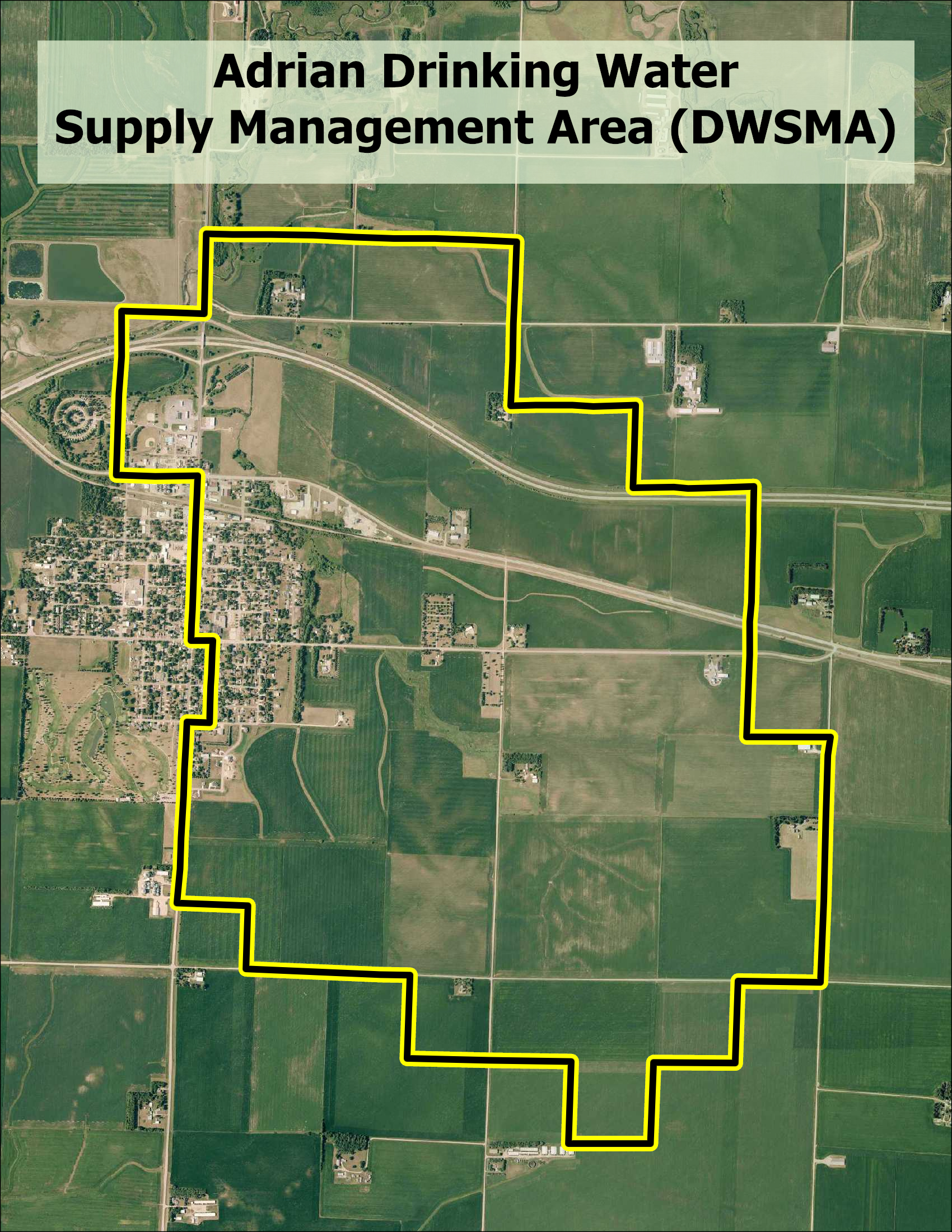
Due to elevated levels of nitrate-nitrogen, the Adrian DWSMA was listed at a Mitigation Level 2 under the Groundwater Protection Rule. To learn more about the determination process visit Mitigation Level Determination.
- Designated a Mitigation Level 2 using the following criteria:
- One or more public wells have exceeded 8 mg/L nitrate within the past 10 years
- No point source of nitrate found to be the cause of the elevated nitrate level
(i.e., ag chemical incidents, animal feedlots, improperly sealed wells, etc.)
- There are three public wells that have tested above 8 mg/L in the past ten years
- The DWSMA is approximately 2,529 acres (high vulnerability area)
- There are 28 cropland owners and operators within the DWSMA
- Located in Nobles County
Local Advisory Team
The MDA established a Local Advisory Team (LAT), consisting of local farmers, agronomists, local government staff, and the public water supplier.
The primary functions of the LAT are to:
- Advise the MDA on the appropriate nitrogen fertilizer best management practices (BMPs) for the project area.
- Explore opportunities to use Alternative Management Tools (AMTs) in targeted high-risk areas.
- Provide the MDA with guidance on the most effective methods to communicate with the agricultural community in the local project area.
- Support the implementation of the BMPs and AMTs at the local level.
From 2020 through 2023, MDA staff met with the Adrian LAT reviewing agronomic information and the MDA’s analysis of nitrogen loss below cropland within the DWSMA. The MDA published a BMP list for the Adrian DWSMA in 2023. In 2025, a new LAT was formed when the Minnesota Department of Health updated the DWSMA boundary that expanded from 108 to 1,990 highly vulnerable cropland acres. Below is a list of milestones that were met during this process. The LAT will continue to meet once annually to review new public well nitrate data and discuss ongoing implementation of practices that protect groundwater within the DWSMA.
Status of the Adrian DWSMA LAT
- Formed a local advisory team
- LAT reformed in 2025 with new members following a DWSMA boundary change and is actively meeting
- The team is actively meeting
- Interviewed local ag retailers and farmers to gather information on the current nitrogen fertilizer management practices within the DWSMA.
- Mapped the boundaries of cropland within this DWSMA
- Completed computer modeling of nitrate loss below the crop rooting zone within this DWSMA
- In consultation with the LAT, a list of BMPs and AMTs that are practicable and appropriate for protecting groundwater within this DWSMA was developed and approved by the MDA.
- A formal evaluation of BMP adoption in the original DWSMA boundary will occur after the 2026 growing season.
- A formal BMP evaluation for the new 2025 DWSMA boundary will occur after the 2029 growing season.
The MDA will continue to work with the LAT, local farmers, crop advisers, and local conservation district partners on communication of the importance of these practices, providing technical assistance, and any grants or cost share funding available to support adoption.

