Principal Investigator: Bruce Wilson
Co-Investigator(s): John Nieber
Organization(s): University of Minnesota, Department of Bioproducts and Biosystems Engineering
Award Amount: $106,125
Start Date: 4/15/2011 | End Date: 12/31/2012
Project Manager(s): Heidi Peterson
FINAL REPORTS are available in the Minnesota Water Research Digital Library
1. Overall Final Report
2. June 30, 2011 Workshop Final Report
Goal of the Project
 The goal of this project was to select sentinel watersheds in Minnesota. These are watersheds that will be used to monitor changes in water quality as a result of conservation practices on the ground.
A sentinel watershed is essentially a model; data collected in a sentinel watershed allows researchers to infer what they would see in another area of the state that has similar landscape features.
Background Information
A watershed is a land area that drains into a common lake, stream, river or ocean.
Water is a precious resource for most Minnesotans. To protect this resource, many projects have been funded at the federal, state and local levels of government. These projects are often focused on data collection and aimed at either addressing a specific research need or solving a particular pollutant problem. Although these projects have provided valuable information, the collected data are often inadequate for Total Maximum Daily Load (TMDLs) studies because:
- Data has not been collected over a long enough time period
- Monitoring plans are not statistically sound
- Lack of technical expertise necessary to properly maintain monitoring equipment
- Data collection was not coordinated with other monitoring in the region
- Data does not include information about important landscape features in the region
Data must be collected in a way that allows it to be used in TMDL studies; otherwise the overall implementation plan may not be effective. What researchers and watershed professionals need is an organized and consistent way to collect meaningful data.
Why is monitoring data needed?
In-field, observed monitoring data is needed to understand the health of the water, to determine water quality standards, and develop realistic expectations for pollutant load reductions.
Sentinel Watersheds
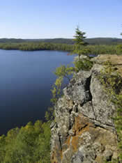
This project used an advisory team to develop criteria and select sentinel watersheds. These watersheds will be used to watch for changes in the health of local waterbodies as well as improve understanding about runoff and other transport processes (i.e. sediment transport from a stream bank to a waterbody).
Information gathered in sentinel watershed will help inform water monitoring efforts all over the state and provide a framework for coordinating data collection. This will lead to more cost effective and consistent procedures.
Sentinel watersheds:
- Represent different landscapes in Minnesota
- Represent a range of physical, chemical, biological and social factors
- Provide information about the role of spatial (space) and temporal (time) scales in the implementation of management practices
Watersheds that have large existing databases are likely to be the most-cost effective.
Completed Research Objectives
- Created an advisory team consisting of key federal, state, and local professionals to assist in establishing selection criteria, to recommend potential sentinel watersheds and to provide input in applying these criteria in the selection process of sentinel watersheds
- Developed criteria to be used in the selection of sentinel watershed that include physical, chemical, biological, and social factors
- Compiled and organized physical, chemical, biological and social information that summarizes the available data that have been collected on the potential watersheds identified under Objective 1
- Prioritized sentinel watersheds by applying the criteria from Objective 2 to the watershed information obtained under Objective 3
Completed Project Tasks
- Created advisory team and working subgroup
- Developed selection criteria
- Compiled and organized existing data for potential watersheds
- Prioritized possible sentinel watersheds